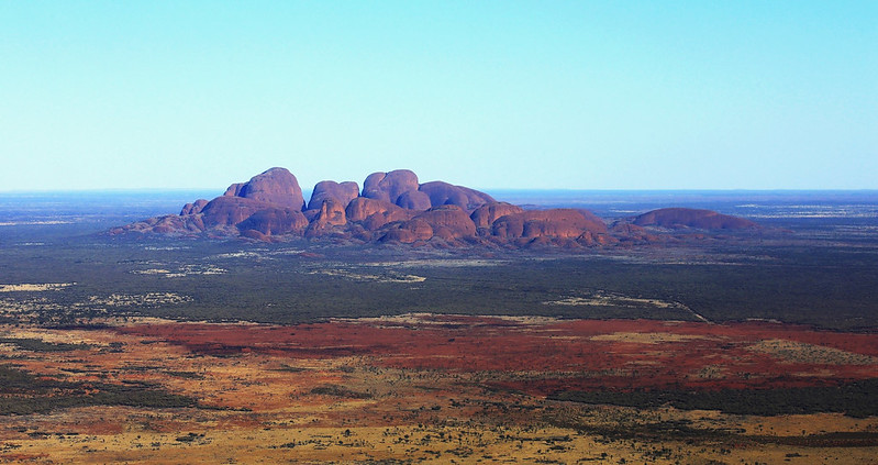
Kata Tjuṯa (means many heads), also known as the Olgas, is a group of large, dome shaped rock formations or bornhardts located about 32 km west of Uluru and 360 km (220 mi) southwest of Alice Springs. Uluru, also known as Ayers Rock, located 25 km to the east, and Kata Tjuṯa form the two major landmarks within the Uluru-Kata Tjuṯa National Park. The 36 domes that make up Kata Tjuṯa cover an area of 21.68 km2 (8.37 sq mi), are composed of conglomerate, a sedimentary rock consisting of cobbles and boulders of varying rock types including granite and basalt, cemented by a matrix of sandstone. The highest dome, Mount Olga, is 1,066 m (3,497 ft) above sea level, or approximately 546 m (1,791 ft) above the surrounding plain (198 m (650 ft) higher than Uluru. They are thought to have been one huge piece of rock, much like Uluru, that has weathered over millions of years to become an intriguing series of individual formations. Kata Tjuta has been listed as Dual UNESCO heritage site.
This was taken on board a helicopter run by the PROFESSIONAL HELICOPTER SERVICES. The domes were illuminated beautifully in the warm spring morning light.
Loading contexts...